Agisoft Metashape Professional Floating Edition

Price range: $6,998.00 through $49,820.00

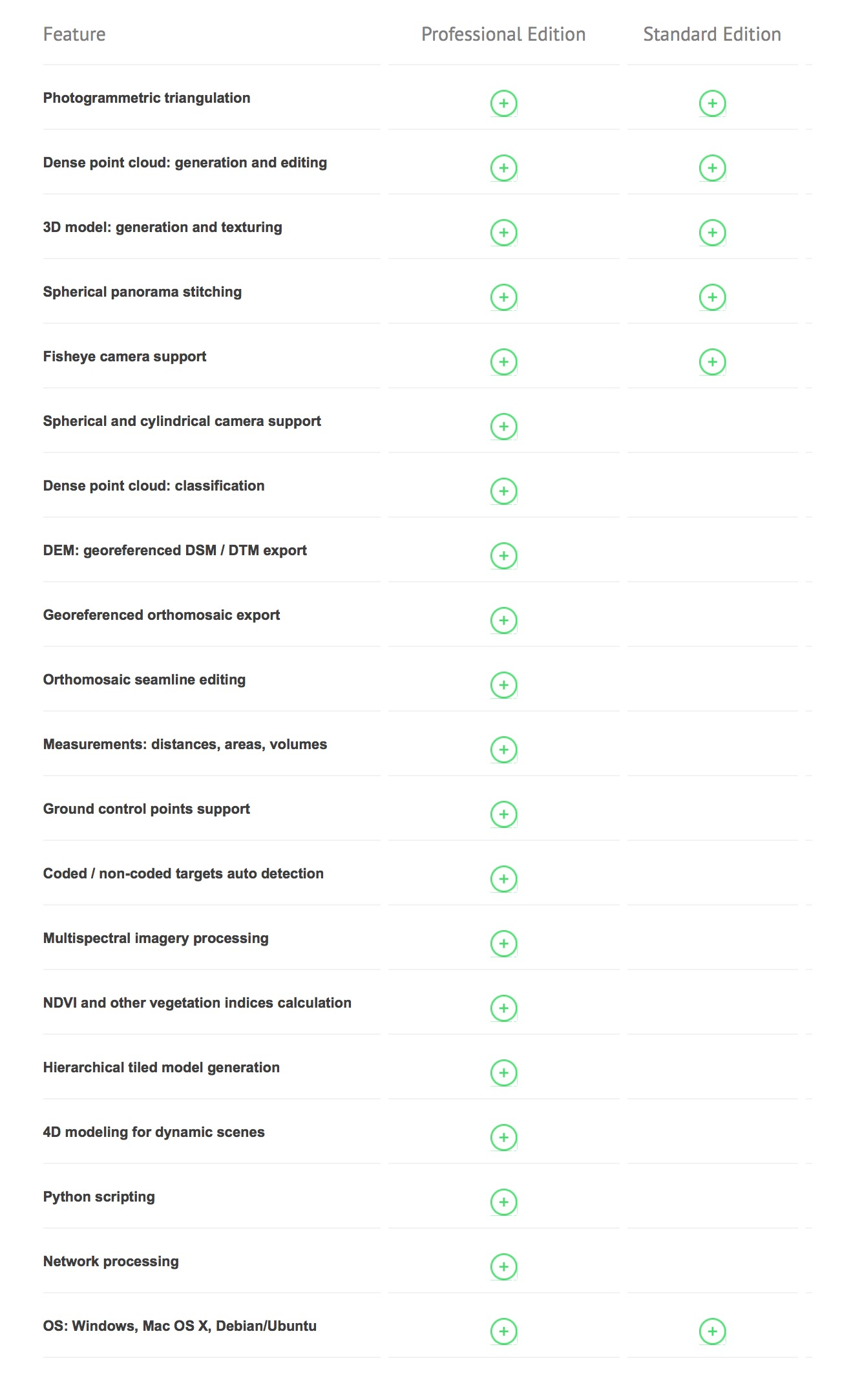
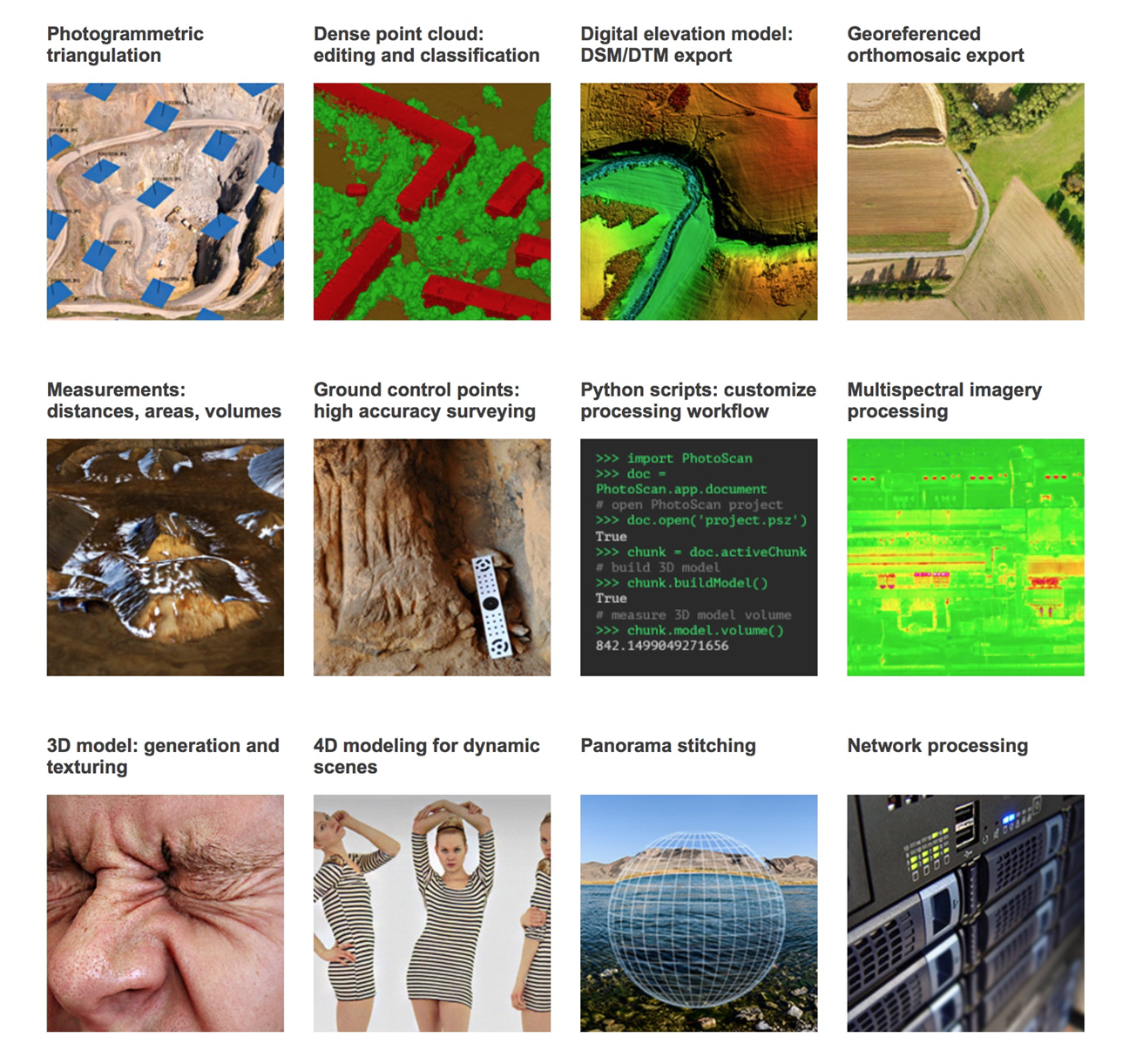
Agisoft Metashape Professional Floating gives laboratories, departments, and technical teams shared access to Metashape Professional across controlled workstations. It supports photogrammetry, 3D reconstruction, dense point clouds, orthomosaics, DEM generation, and advanced measurement workflows.

Request Quote

This product can be purchased directly online, but a quote request is also available if you need configuration review, institutional purchasing support, delivery planning, or help confirming fit before ordering.

Software downloads

Installer links for this Agisoft license

Purchase provides license processing and registration-code delivery. These installer links are provided here so buyers can quickly find the matching platform download.

Metashape 2.x update notes

  • Updates to Metashape 2.x are free of charge.
  • Professional 1.x users may need to re-enter their license code when launching Metashape Professional 2.x because Agisoft introduced a new Professional activation system.
  • Metashape Standard uses the same activation system as earlier versions, so Standard users do not need to re-enter a license code when updating to version 2.x.
  • Professional 2.x floating licenses require the current Agisoft License Server and are not compatible with the older RLM license server. Agisoft License Server instructions

Description

Agisoft Metashape Professional Floating Edition is shared professional photogrammetry licensing for labs and teams. Macroscopic Solutions supplies Agisoft Metashape licenses for scientific, technical, educational, and cultural-heritage imaging workflows.

What this license is for

Choose this license when multiple qualified users need access to Metashape Professional and a floating license model fits the lab, department, or production environment better than a single dedicated workstation.

Common applications

  • Photogrammetry and 3D reconstruction from overlapping photographs
  • Dense point clouds, textured meshes, orthomosaics, and digital elevation models where supported by the selected edition
  • Museum, university, natural-history, archaeology, geoscience, engineering, UAV, and collection digitization projects
  • Macropod PRO 3D image sets, specimen imaging, object documentation, field imaging, and teaching demonstrations

Who typically buys it

This license is commonly selected by university labs, shared imaging facilities, museum digitization groups, geospatial teams, engineering departments, and collaborative scientific imaging programs.

Delivery and support

This is a virtual software-license product. No physical shipment is required. After purchase, Macroscopic Solutions processes the license order and registration-code delivery by email. Current Metashape 2.3.1 installer links for supported operating systems are shown on this page for convenience.

Metashape 2.x update notes

Updates to Metashape 2.x are free of charge. Professional 1.x users may need to re-enter their license code when launching Metashape Professional 2.x because Agisoft introduced a new Professional activation system. Metashape Standard uses the same activation system as earlier versions, so Standard users do not need to re-enter a license code when updating to version 2.x.

Metashape Professional 2.x floating licenses are not compatible with the RLM license server used in earlier versions. Floating-license users should install the current Agisoft License Server and activate floating licenses with their license code.

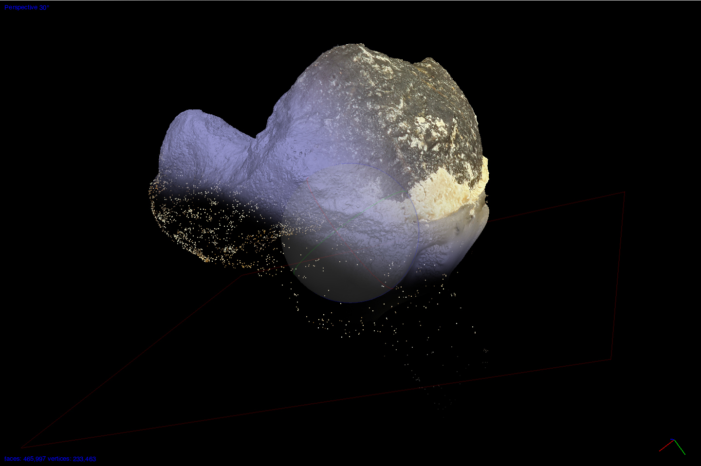
3D photogrammetry example

Dolphin vertebrae 3D model

This approximately 20 cm wide dolphin vertebrae model shows the kind of large-subject 3D result produced after a carefully captured image set is aligned, reconstructed, textured, and exported from Agisoft Metashape.

Use the viewer to rotate, zoom, and inspect the actual 3D model reconstructed from the image set.

From controlled images to an interactive model

  • Capture a consistent, overlapping image set with the configured Macropod PRO 3D, Canon R5, and controlled lighting.
  • Focus-stack individual viewpoints when the subject has more depth than one exposure can hold.
  • In Agisoft Metashape, align images, build depth-based geometry, inspect the model, create texture, scale it, and export the required files.

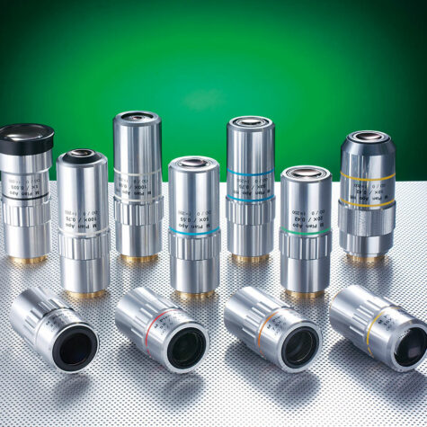
Macropod PRO 3D supplies controlled specimen capture; the Micro Kit extends fine-detail work with current Mitutoyo objectives. Agisoft Metashape turns the image set into the reconstruction.

Additional information

Operating System

Windows x64, Windows x32, Mac OSX, Linux

License No.

Single, 3 License Pack, 5 Licenses Pack, 10 Licenses Pack, 20 Licenses Pack

Product tags

3D modeling from photos 3D reconstruction software Agisoft Metashape cultural heritage 3D dense point cloud department software license digital elevation model software drone photogrammetry electronic software delivery floating license geoscience photogrammetry lab photogrammetry software Macroscopic Solutions software Metashape floating license Metashape professional Metashape standard museum digitization orthomosaic software photogrammetry license photogrammetry software research photogrammetry scientific imaging software shared software license structure from motion UAV mapping software

Reviews

There are no reviews yet.

Be the first to review “Agisoft Metashape Professional Floating Edition”

Your email address will not be published. Required fields are marked *

Photogrammetry and 3D reconstruction

Agisoft Metashape is the leading professional photogrammetry platform for turning photographs into accurate 3D data.

Use Metashape to reconstruct specimens, rock outcrops, field sites, terrain, museum objects, cultural heritage material, and research collections from carefully captured image sets.

Researcher photographing a rock outcrop with photogrammetry control targets for 3D reconstruction

Rock outcrops and geologic structure

Build measurable 3D reconstructions of outcrops, stratigraphy, structural surfaces, and field-scale exposures from overlapping photographs.

Scientific specimen photographed from multiple angles on a turntable for 3D reconstruction

Specimens, fossils, and collections

Turn controlled image sets from lab, museum, and collection workflows into textured models for research, teaching, exhibits, and digital archives.

Photogrammetry model stages showing a textured fossil-bearing rock, point cloud, and triangulated mesh

Dense clouds, meshes, textures, and scale

Process photographs into dense point clouds, polygon meshes, textured models, orthomosaics, DEMs, and scaled deliverables for technical documentation.

Drone and ground camera photogrammetry workflow reconstructing a field site as a 3D terrain model

Field sites, terrain, and environmental records

Combine ground photos, drone imagery, survey targets, and control points to reconstruct excavation areas, terrain surfaces, field sites, and landscape features.

Company research & purchasing resources

Review the broader Macroscopic Solutions record.

These company-level resources provide background on Macropod-related research, selected company work, and purchasing support. They may not evaluate or document the specific product on this page.

Watch & learn

See this equipment in real workflows.

These videos are matched to this product from Macroscopic Solutions tutorials, demonstrations, research examples, and customer conversations.

Open the complete learning center →

Prefer finished imagery instead?

Have Macroscopic Solutions capture and build the 3D model.

Use controlled acquisition, focus stacking, Metashape processing, model cleanup, and project-scoped delivery for a finished scientific 3D asset.